


Nánari upplýsingar
Overview
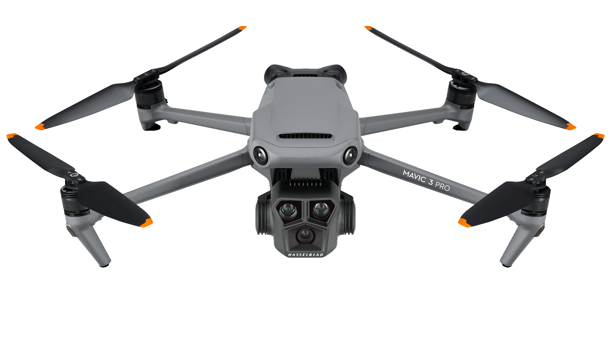
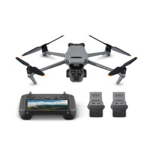
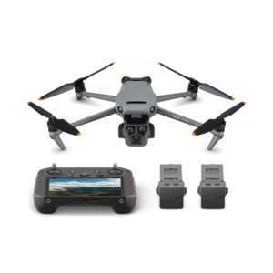
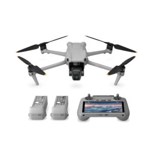
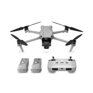
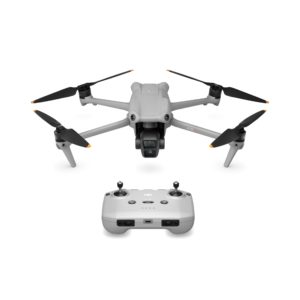
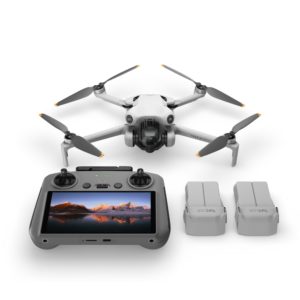
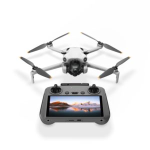
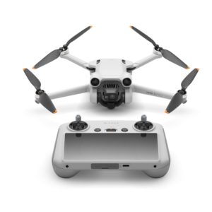
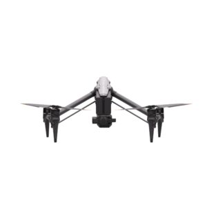
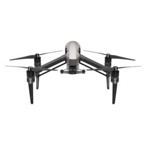
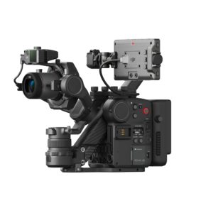
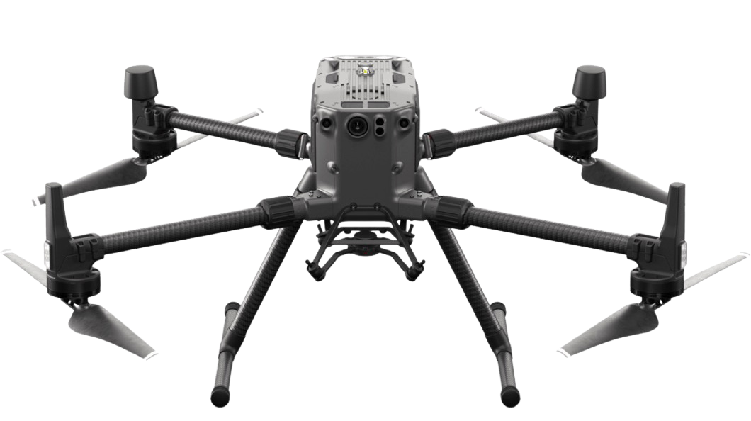
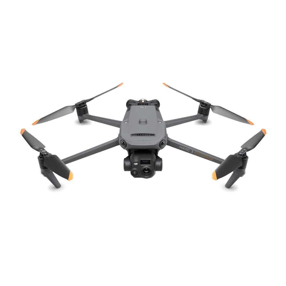
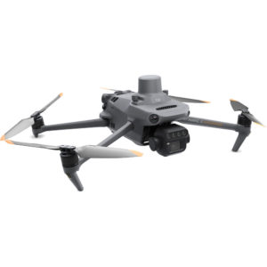
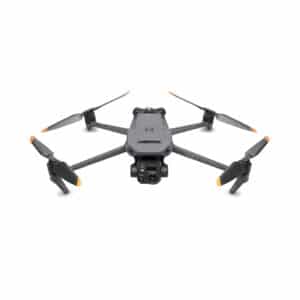
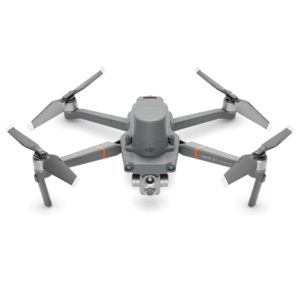
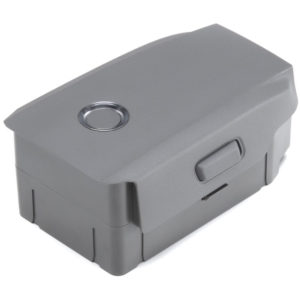
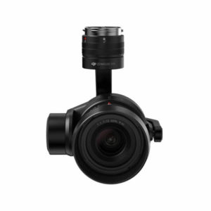
Obtain more actionable data when making aerial surveys and inspections with the Mavic 3M Multispectral Drone with 2 Years of DJI Care Enterprise Basic from DJI. The gimbal payload of the Mavic 3M provides a 20MP RGB camera, so you can take essential visible light images and videos, and four 5MP multispectral cameras are capable of recording in other spectrums. The multispectral cameras include Green, Red, Red Edge, and Near Infrared.
The Mavic 3M is ideal for many industries including agriculture, surveying, and inspection. In agriculture, multispectral cameras are essential for judging accurate vegetation and crop health. When surveying, the RGB sensor, RTK module, and Mavic 3M’s omnidirectional wide-FOV sensors allow for centimeter-level accuracy – even for terrain-following on steep-slope landscapes.
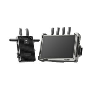
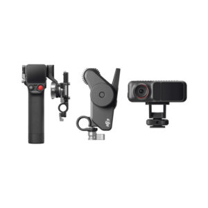
RTK Module
Add this module to the Mavic 3M for centimeter-level RTK positioning with microsecond-level time synchronization between the module, flight control, and camera. This allows for high-precision aerial surveying without the need for ground control points
Sunlight Sensor
This captures solar irradiance and records it to an image file, allowing for light compensation of image data during 2D reconstruction. It also results in more accurate NDVI results, improved data accuracy and consistency over time.
Open Ecosystem
- Cloud API: Directly connect the Mavic 3M to a third-party cloud platform via the Pilot 2 app’s built-in DJI Cloud API that’s based on the MQTT protocol. This removes the need and cost of developing a custom app for transmission of UAV equipment information, live streaming, photo data, and more.
- MSDK: Support for Mobile SDK 5 (MSDK5) with a fully open-source production code sample. This support makes it possible to develop a proprietary control app for UAV field patrol, smart surveying, and other scenarios.
Additional Features
- Fast 1/2000s mechanical shutter and 0.7 second high-speed burst in RGB
- Up to 43 minutes of cruise time
- Cover up to 200 hectares per flight
- Omnidirectional obstacle avoidance
- O3 transmission with 2 transmitting and 4 receiving antennas for up to a 15 km range
- Foldable design for easier storage
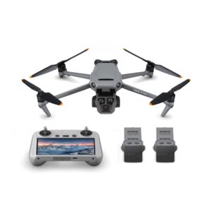
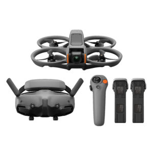
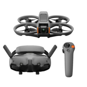
DJI Mavic 3M
749.900 kr.
- Ideal for Agriculture & Surveying
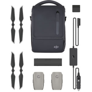
- 2 Years of DJI Care Enterprise Basic
- 20MP RGB & 4 x 5MP Multispectral Camera
- Green, Red, Red Edge & Near Infrared
- RTK for Centimeter-Level Precision
- Omnidirectional Obstacle Avoidance
- Wide-FOV Sensors for Sloped Terrain
- Integrated Sunlight Sensor
- Up to 43 Minutes of Cruise Time
- O3 Transmission up to 15 km
Out of stock
Viltu fá tilkynningu þegar þessi vara er aftur á lager?
Nánari upplýsingar
Overview
Obtain more actionable data when making aerial surveys and inspections with the Mavic 3M Multispectral Drone with 2 Years of DJI Care Enterprise Basic from DJI. The gimbal payload of the Mavic 3M provides a 20MP RGB camera, so you can take essential visible light images and videos, and four 5MP multispectral cameras are capable of recording in other spectrums. The multispectral cameras include Green, Red, Red Edge, and Near Infrared.
The Mavic 3M is ideal for many industries including agriculture, surveying, and inspection. In agriculture, multispectral cameras are essential for judging accurate vegetation and crop health. When surveying, the RGB sensor, RTK module, and Mavic 3M’s omnidirectional wide-FOV sensors allow for centimeter-level accuracy – even for terrain-following on steep-slope landscapes.
RTK Module
Add this module to the Mavic 3M for centimeter-level RTK positioning with microsecond-level time synchronization between the module, flight control, and camera. This allows for high-precision aerial surveying without the need for ground control points
Sunlight Sensor
This captures solar irradiance and records it to an image file, allowing for light compensation of image data during 2D reconstruction. It also results in more accurate NDVI results, improved data accuracy and consistency over time.
Open Ecosystem
- Cloud API: Directly connect the Mavic 3M to a third-party cloud platform via the Pilot 2 app’s built-in DJI Cloud API that’s based on the MQTT protocol. This removes the need and cost of developing a custom app for transmission of UAV equipment information, live streaming, photo data, and more.
- MSDK: Support for Mobile SDK 5 (MSDK5) with a fully open-source production code sample. This support makes it possible to develop a proprietary control app for UAV field patrol, smart surveying, and other scenarios.
Additional Features
- Fast 1/2000s mechanical shutter and 0.7 second high-speed burst in RGB
- Up to 43 minutes of cruise time
- Cover up to 200 hectares per flight
- Omnidirectional obstacle avoidance
- O3 transmission with 2 transmitting and 4 receiving antennas for up to a 15 km range
- Foldable design for easier storage