990.000 kr.
The P1 will be available for order in early 2021.
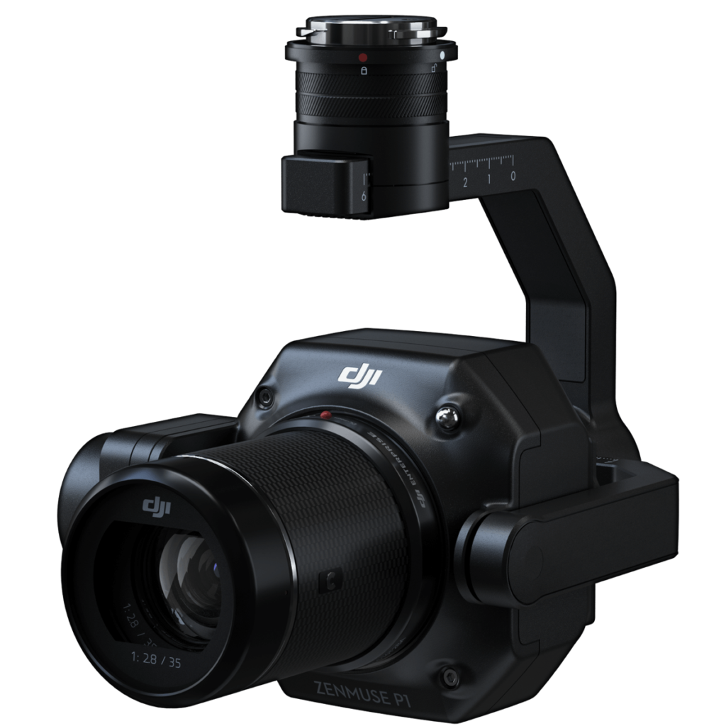
The Zenmuse P1 integrates a full-frame sensor with interchangeable fixed-focus lenses on a 3-axis stabilized gimbal. Designed for photogrammetry flight missions, it takes efficiency and accuracy to a whole new level.
3 cm horizontally / 5 cm vertically [1]
3 km2 covered in a single flight [2]
Full-frame Sensor
Smart Oblique Capture
Shutter Speed 1/2000 Seconds
synchronization at the microsecond level
The P1 includes a full-frame, low-noise high-sensitivity sensor that can take a photo every 0.7 s during the flight, and covering 3 km2 [2] in a single flight.
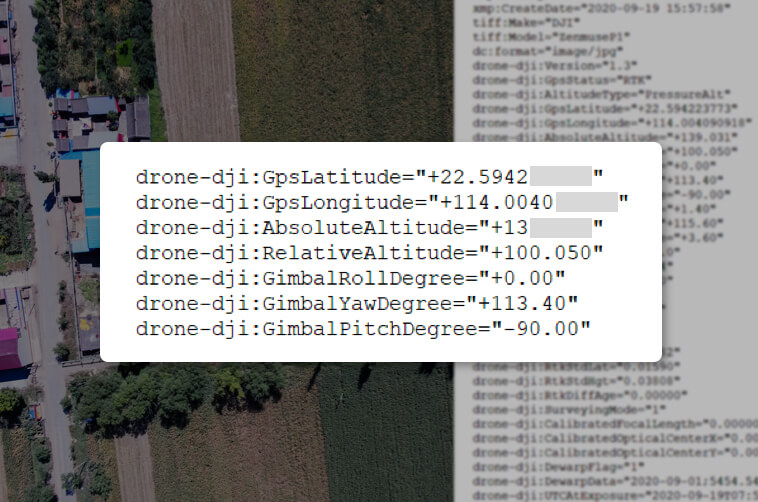
Equipped with a global mechanical shutter and the all-new TimeSync 2.0 system, which synchronizes time across modules at the microsecond level, the Zenmuse P1 lets users capture centimeter-accurate data combined with the real-time position and orientation compensation technology.
Create 2D, 3D, and detailed models thanks to the integrated 3-axis gimbal that can be outfitted with 24/35/50mm lenses and the Smart Oblique Capture feature.

Cover 7.5 km2 [4] in a single workday with the P1. Elevate the efficiency of your oblique photography mission using Smart Oblique Capture, where the gimbal automatically rotates to take photos at the different angles needed. Only photos essential to the reconstruction will be taken at the edge of the flight area, increasing the efficiency of post processing by 20%[5] to 50%[6].
Your mission data management – streamlined.
Mission result files are automatically associated with the Mission Name and Mission Time.
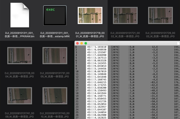
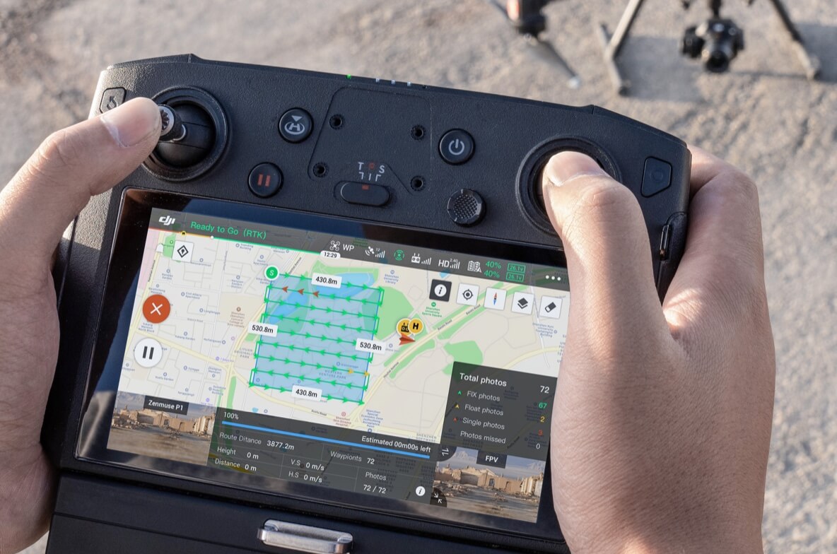
Verify data quality immediately post-flight by checking the position data and number of the images acquired, as well as RTK status and positioning accuracy.
Generate orthomosaics without GCPs using the P1, perfect for medium to large-area operations.
Effortlessly acquire oblique images from multiple angles that meet 3D modeling requirements across industries such as urban planning and centimeter-level accurate cadastral surveys to serve 3D reality models and smart city planning.
Acquire ultra-high resolution image data of vertical or slanted surfaces from a safe distance that faithfully recreates fine textures, structures, and features, for detailed reconstructions, geological surveys, heritage site conservation, hydraulic engineering, and more.
Gather geographic information of large areas in real-time using DJI Terra so that teams can make crucial decisions quickly on site.
Capture data that meet the 1:500 scale accuracy requirements without GCPs.
Learn more
Quickly generate centimeter-level accurate 3D reality models.
Learn more
Manage the full project lifecycle with 2D and 3D drone data.
Learn more
Measure, classify, or determine the ownership of water bodies and forests.
Learn more
Safely gather millimeter-level accurate aerial data of geological hazard sites.
Learn more
Gain real-time overviews of vast disaster-struck areas to help teams make critical decisions.
Learn more
990.000 kr.
Við látum þig vita þegar varan er komin aftur á lager