2.349.000 kr.
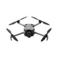
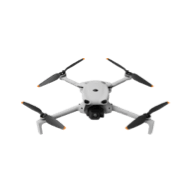
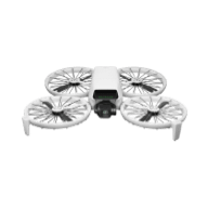
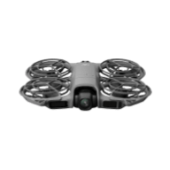
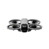
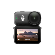
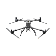
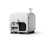
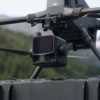
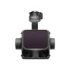
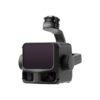
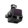
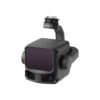
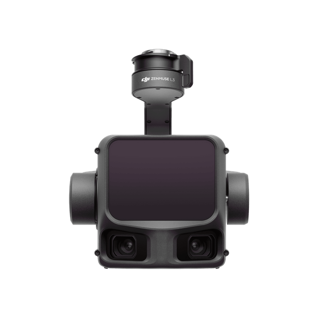
The DJI Zenmuse L3 sets a new standard for accurate and efficient aerial data acquisition. Equipped with an advanced 1535 nm long-range LiDAR, two 100 MP RGB cameras, and a high-precision POS system, the L3 delivers outstanding performance. The system enables coverage of up to 100 km² per day, providing professionals in surveying, infrastructure, and inspection with a powerful tool for precise and efficient data collection.
2.349.000 kr.
Ekki til á lager
Includes Zenmuse L3, Lens Cap, CFexpress™ Memory Card (1 TB) × 2 (brand may vary; actual product received prevails), Zenmuse L3 Single Gimbal Connector, Card Reader, and more. Backed by a 1-year complimentary repair service (within the coverage limit).
The L3 introduces a powerful 1535 nm LiDAR with a 950 m[1] detection range and efficient mapping altitudes of 300–500 m[3]. When paired with the Matrice 400, it can cover up to 10 km² per flight and 100 km² per day[2], making it ideal for large-scale surveying.
A new 0.25 mrad (1/e²) laser divergence creates a spot five times smaller than L2, enabling reliable detection of thin objects like power lines and delivering significantly better ground penetration through vegetation for cleaner, denser terrain data.
With 2 million pulses per second and up to 16 returns[4], L3 captures extremely detailed point clouds suited for high-accuracy mapping and complex environments such as forests, power corridors, and industrial sites.
Two 100 MP RGB mapping cameras with a 107° ultra-wide field of view deliver high-resolution imagery and allow both DOM and DEM data to be collected in a single flight—even at high altitudes—boosting overall efficiency.
An upgraded POS system provides 0.02° heading and 0.01° pitch accuracy, with LiDAR vertical accuracy better than 3–10 cm depending on altitude. Point cloud thickness is half that of L2, enabling clearer and more reliable measurements.
Fully integrated with DJI Terra, FlightHub 2, and DJI Modify, the L3 supports real-time point cloud previews, cloud syncing, advanced classification, and fusion-based modeling, simplifying the entire mapping workflow from acquisition to final deliverables.
2.349.000 kr.
We will let you know when the product is back in stock
1. a. Range Definition: The range is defined as the distance at which 50% of the emitted laser pulses are detected. If a laser beam hits more than one subject, the total laser transmitter power is split and the achievable range is reduced.<br>
b. Test Conditions: 100 klx ambient light, within the central area of the FOV, using a flat subject with a size larger than the laser beam diameter, a perpendicular angle of incidence, and an atmospheric visibility of 23 km.<br>
c. The maximum detection range is 900 m by default. For a longer range, contact DJI support or an authorized dealer.
2. When paired with DJI Matrice 400, Zenmuse L3 can achieve a daily mapping coverage of up to 100 km² (flat terrain, 300m nadir flight altitude, 20% side overlap, 17m/s flight speed, and a total effective flight time of 6 hours).
3. The flying altitude limit varies in different countries or regions. Make sure to fly at the altitudes outlined by local laws and regulations.
4. Support for 16 returns is limited to laser pulse emission frequency of 100 kHz and 350 kHz.